I’m a New Yorker, and I run. I get bored doing laps around the park or running up and down the Hudson River path. Instead, I use my long-distance runs to explore the neighborhoods in my city, especially in the outer boroughs. I’ve decided to take a cheap digital camera with me on some of my runs to document the city and its changes as seen when crossing on foot.


Wednesday, May 19, 2010

The Sixth Borough: Hudson County, NJ


The cities just on the other side of the Hudson—especially Jersey City and Hoboken—are like a mirrored New York. Because Hudson County is surrounded on three sides by water (the Hudson, Kill Van Kull, Newark Bay, and the Hackensack River and Meadowlands marsh), it feels almost as separate from the rest of New Jersey as Manhattan does. It's densely packed, has a skyline that would do a Cleveland or a San Jose proud, and a big-city worthy transit network, with both a new light-rail trolley and a subway (the PATH) connecting to lower Manhattan and the Village. (Click here for the interactive map of my run.) If you can ignore the arbitrary political boundaries, JC and Hoboken are almost as woven into the fabric of the city as Brooklyn and Queens across the opposite river.

But those boundaries are hard to ignore. To the average NYC snob—and I'm afraid I'm one of those—the first stop on the PATH over the river might as well be the Moon or Montclair. It's still, you know, New Jersey. Historically, there's evidence that even people who've live in Jersey City haven't had a strong sense of their hometown as a distinctive, interesting place on the map. In her memoir The Place You Love Is Gone, former Hoboken resident Melissa Holbrook Pierson writes:
In the late fifties some researchers finally went around and asked people the most important thing of all: what the places they lived in felt like. Of the three cities studied, Boston, Los Angeles, and Hoboken's twin, Jersey City, the latter was found to be peculiarly poorly differentiated or "imageable," as the study has it. Its denizens' recall of its layout was far worse than those in the other two cities: "Many descriptions of the scene by established residents, young or old, were accompanied by the ghosts of what used to be there. Changes, such as those wrought by the freeway system, have left scars on the mental image."
Much more change was to come. They knocked down the minor-league stadium where Jackie Robinson played the first integrated pro baseball game. A gated condo development stands in its place. Later, JC sprouted a slick new waterfront business district of glassy office towers and "luxury" apartments for the junior financial analysts and computer programmers who toil there. If you've been to Arlington's Pentagon City, the London Docklands, or Cambridge's Kendall Square, you've been to the JC waterfront. That's where my run started. After that, things quickly get more interesting—the city really won me over. There are blocks and blocks of Brooklynesque brownstones. The way you know you aren't in Cobble Hill is that the power and telephone lines are all overhead, and the neighborhoods are arranged around gorgeous Victorian square parks. Some buildings on the corner lots have street markers on their walls, like you see in Europe.

Then there's the former Jersey City Medical Center, a huge mass of Art Deco skyscrapers built with money from the Works Progress Administration. It was the special project of Mayor Frank Hague, a classic Democratic machine boss. According to this New Jersey City U. site, the
Medical Center provided free care to residents who couldn't pay, which must have been most of them—the hospital cost $3 million a year to run, but supposedly billed patients just $15,000 in 1929. It went bankrupt in 1988. The buildings have since been converted into loft-style condos. I think you have the whole social history of the U.S. over the last 50 years right there...

My run also took me through Journal Square, JC's real commercial hub and the heart of its large Filipino and South Asian communities. On the other side of the Holland Tunnel entrance from Jersey City is Hoboken, the funny-sounding mile-square city of Frank Sinatra, On the Waterfront, Yo La Tengo, and my favorite book when I was ten. (It occurs to me now that jogging with a camera is a very Pinkwater kind of hobby.) Since the 1980s, Hoboken has gone from working-class 'burg of cold-water tenements ("The place they forgot to clean, forgot to love, forgot," writes Pierson) to affluent urban playground. A rash of deadly arsons preceded a boom in development; it seems like it was an easy way to clear out low-rent tenants. Today, Hoboken is certainly beautiful—compact, walkable from end to end, packed with old brick townhouses—but it also makes Park Slope seem diverse and edgy. The city has a W hotel now. And a Five Guys. All it needs now is an NYU dorm. As Pierson writes about Hoboken's '80s transformation: "Hoboken was not changing so much as being eradicated. They kept only the name the same."

Like I said, it's really just another part of New York.

Now on to the pictures, most of them after the jump:

From jersey
Starting at the waterfront

Wednesday, April 28, 2010

Industrial Brooklyn: The Eastern District and English Kills

In 1854, the City of Brooklyn annexed the City of Williamsburgh (still with the mysteriously lost "h" then) and the Town of Bushwick. These areas became Brooklyn's Eastern District.

Which is confusing. The old Eastern District is the far northern tip of the modern borough, and is now generally referred to as North Brooklyn. I usually think I'm headed straight north when I go from my home in Fort Greene up to Williamsburg, but as you can see from the map, that isn't quite accurate--it's the same kind of schematization of a mental map that, as Tom Vanderbilt explained recently in Slate, causes people to think San Diego is west of Reno. Most Brooklynites are hopeless about cardinal directions. Unlike, say, Manhattan or Chicago, the street grid doesn't help--because so many neighborhoods were once their own city or village, Brooklyn has multiple grids that crash together at weird angles. People also tend to orient themselves to Manhattan, and the Williamsburg Bridge is "uptown" of the Brooklyn Bridge, even though it's at least as geographically accurate to say that it's to the east. If you can wrap your head around that fact, you've gone a long way toward your black belt in Not Getting Lost In Brooklyn.

This run was a couple of months ago, during the lashing rain storm that brought down so many old trees in the New York area. (You can see my interactive MapMyRun map here.) Fortunately, there weren't many trees on my route, because this run took me through the industrial heart of the Eastern District. I had wanted to check out two things. First, I had been vaguely aware that Bogart Street was turning into New York's latest artist/hipster quarter. (As a much cooler co-worker said to me later, "Were you the only guy there without a beard?" Yes.) And I wanted to see a couple of the more obscure bridges in the city, which cross the Newtown Creek and its tributary, English Kills.

As you'll guess looking at the blurred photos, I came pretty close to wrecking my camera in the rain. And I didn't notice probably the most interesting buildings on my route: the Williamsburg Houses. But I'll have more on those in my next post.

From brooklyn industry
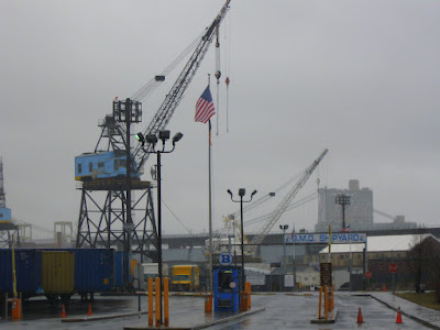
The Navy Yard waterfront


From brooklyn industry
Working man's kosher


From brooklyn industry
The pformer Pfizer pfacility


From brooklyn industry
All Saints

From brooklyn industry


From brooklyn industry


From brooklyn industry
Apparitions of Our Lady of Guadalupe and the miracle of the roses

From brooklyn industry
Just off Bogart Street

From brooklyn industry
Cafe Orwell

From brooklyn industry
Bogart Street


From brooklyn industry


From brooklyn industry
I should have bought one of those slickers.

From brooklyn industry
For the subtle and discriminating gentleman

From brooklyn industry
English Kills

From brooklyn industry
Metropolitan Ave. Bridge over English Kills

From brooklyn industry
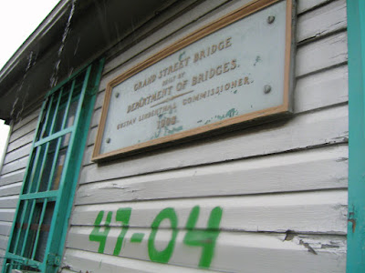
Grand St. Bridge over Newtown Creek, Brooklyn side

From brooklyn industry


From brooklyn industry
Queens side

From brooklyn industry
Bridge operators shack. (The bridge can swing open.)

From brooklyn industry


From brooklyn industry
Back near the Navy Yard

From brooklyn industry
Washington Avenue

Things One Carries While Running

Your blogger sometimes finds running with a camera a bit awkward.

And then there a people who run with laser-sighted pistols loaded with hollow-point bullets.

From the AP:

AUSTIN -- Pistol-packing Texas Gov. Rick Perry has a message for wily coyotes out there: Don't mess with my dog.

Perry (R) told the Associated Press on Tuesday that he needed just one shot from the laser-sighted pistol he sometimes carries while jogging to take down a coyote that menaced his puppy during a February run near Austin.

Perry said he carries his .380 Ruger -- loaded with hollow-point bullets -- when jogging on trails because he is afraid of snakes. But when a coyote came out of the brush toward his daughter's Labrador retriever, Perry charged.

I visited Austin a couple of years ago, and had a great run there along the river. It hadn't occurred to me that some of my fellow joggers might have been packing heat. I think I'm glad I didn't know.

Monday, April 26, 2010

A short run in Clinton Hill and Bedford-Stuyvesant

This blog's been quiet lately because I haven't been running much. I needed some time to recover from the marathon, and I had a big story to write for my magazine. More to come soon, but here are some shots from my first run after the big race. It was just a couple of miles near my house, and went past what's left of Broken Angel.

From recovery run
Ghost bike on Greene


From recovery run
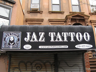
Jaz Tattoo came to a party at my house once. A name you don't forget...


From recovery run
The Broken Angel


From recovery run


From recovery run
Bed-Stuy greystones; unusual for this area


From recovery run
Evening Star Baptist


From recovery run
An interesting new brownstone infill


From recovery run
A former "Sonntag's schule"—Sunday school


From recovery run
Almost none of my neighborhood—or Brooklyn—looks like
this anymore. Which is why I took this picture...

.

Tuesday, March 23, 2010

Race Report: National Marathon in D.C.

My daughter runs to meet me around mile 16, on Constitution Avenue:


The last runner in race, juggling as he goes:


Don't let the sweeper catch you:


Later that day, my first beer in three months:


My wife took the pictures; I didn't bring my camera for this run. I'm not one of those runners who fights for PRs, so I wasn't worried about losing time. But I was a bit worried about finishing. This wasn't my first marathon—that was the Illinois Marathon, a year ago—but I didn't have time to train as well for this one.

I finished, but I was right to worry. The National is a challenging marathon with a lot of hills. It starts with a long gradual climb toward Capitol Hill from the east, which you have to repeat after mile 13. There's also a sharp hill from DuPont Circle up to Kalorama Park and Adams Morgan. (Years ago, on a business trip to D.C., I remember hitting that hill on a short run from my hotel and not being able to take it.) Somewhere after mile 23 in Anacostia, there's a final rise that's a real killer.

But what really made the race hard was the weather: By the time I finished, it was over 75 degrees. And of course I wasn't trained for that kind of heat. My last long run had been in freezing, pelting rain and tree-ripping wind; the one before that, I was climbing over piles of snow on every curb.

The race was well-organized and I had fun, but I wouldn't recommend it to most slow marathoners, especially if you're the kind who finds it helpful to run in a crowd with a lot of spectator support. You have to qualify with a sub-5-hr. marathon to run it. My previous race was 4:50, and that meant I started in the very last corral. Most of the people in that corral were signed up for the concurrent half-marathon. Since it was also their last corral, it meant that I was sharing the course with people who were about as uncertain of their ability to complete 13 miles that day as I was of finishing 26. I'm hardly going to complain about them—we slow-motion, long-distance joggers are a band of brothers and sisters—but it isn't easy psychologically to watch so many people dropping out or walking just nine or ten miles in when you still have 16 to go.

And when the halfers split off, the back of the pack got very lonely. Spectators are pretty thin in this marathon (probably because it starts at 7 o'clock) and that's especially true in the back half, which runs through an industrial and warehouse district in the SE quadrant and then through a shadeless riverfront park along the Anacostia.

Even so, I loved the course. I go to D.C. often on business, and it's a city I've had mixed feelings about. It's full of interesting people and impressive architecture, but the downtown and the Federal buildings are a flop in terms of urbanism. Because government buildings take up whole blocks, you can walk for a very long time before finding a cafe or a shop--and when you do, it's likely to be a Starbucks or an Au Bon Pain. It just doesn't feel like a city in those parts. But the race course quickly breaks away from Monumental Washington and into D.C.'s real neighborhoods of painted brick row houses, bars, restaurants and universities (notably Howard). It turns out to be a beautiful, lively town.

Seeing my wife at kids and mile 16 helped get me through the hard slog. So did a runner I met as we limped through mile 24. I had just just pounded down a Powerade and let out a loud belch. That inspired the guy next to me to tell a joke:
Two strangers, a man and woman, have adjacent bunks on a train's sleeper car. The man takes the top bunk, and the woman takes the bottom bunk, which is near the cubby where the blankets are kept. The lights go out. A half hour passes. The guy calls down to the woman below:

"Its chilly in here. Can you hand me another blanket?"

"I have an idea," she says. "How about just for tonight we pretend we're married."

"Sounds like a great idea," he says.

"Good... get your own f----ing blanket."

Five minutes later, he farts.
Okay, that's pretty terrible. But it ate up a quarter mile of pain. Thanks Mystery Joke Guy!

Tuesday, March 9, 2010

Run to Forest Park and Highland Park and around the interborough necropolis

To best view the slideshow, click on the black border first, then the blue play button. If you click the green play button or the photo first, you will be redirected to my Picasa page. It's a bug I hope Google fixes soon.

Look at a map of Brooklyn and Queens and you'll see a long swath of green straddling the borough line. It's not a park, but a jumble of the Jackie Robinson Parkway, two great wooded parks linked to Olmsted, a golf course, and more than a dozen cemeteries. This run circled the whole complex, mostly by way of Myrtle and Jamaica avenues. It was a slightly disappointing outing: Heavy snow made the going difficult and prevented me from exploring much of the parks. I also felt a bit chilled toward the back half and had to cut short a planned 20-mile run at about 15.

Still, I reached the main goal of the run: The little-known, hill-climbing Brooklyn enclave of Highland Park, and the park of the same name. The park sits on top of the borough line and includes the old Ridgewood Reservoir. When Brooklyn was its own city, it drew its water from Long Island. The borough was later linked up to NYC's system, which draws from the Catskills, but traces of the old system survive on the map: Conduit Blvd./Ave., Aqueduct Racetrack, and the magically named Force Tube Avenue.

At very the end of A Walker in the City, Alfred Kazin describes his walks around the reservoir, which sits atop a high hill, and its views of the city skyline on one side and the flatlands of East New York and Brownsville on the other. The park appears as the center point on which his whole life has balanced.

On Google Maps, the reservoir looks like three lakes with a running path. I had expected a scenic run around a frozen pond. But as you can see in the photos, what I found was a chain-link fence surrounding a sunken wood. Turns out the reservoir's been drained, although a small natural pond remains in the middle basin. The land is closed off, creating a huge natural green space in the middle of the city. Here's a Flickr set I found which suggests that its quite beautiful on other side of that fence. The parks department acquired the land a few years ago and there's been a fight over what to do with it. Environmentalists, preservationists, birdwatchers and people who choreograph dances about abandoned reservoirs want to keep the land much as it is. The parks department and some church groups and community activists would like see a part of the land used for ball fields. Highland Park is adjacent to some of New York's poorest communities, so there's a case to be made that recreational facilities could be the greater good here. I can see both sides on this one—here's a fairly balanced take. But whatever happens, I hope there's a way to make the reservoir more accessible. If a fraction of the civic energy that went into opening up the High Line in Manhattan could go into Highland Park, it seems like we could do something spectacular in part of the city that could use a little love.

Other highlights:
  • Along Myrtle Ave. in Bushwick, the remnants of the old Myrtle Ave. El, which used to have a station right at my building's front door.
  • A tumbledown Bushwick mansion that used to be the home of Frederick Cook, who—depending on which part of the Internets you want to believe—was either robbed of the distinction of being first to reach the North Pole or was "a criminal sociopath whose ill gotten gains were inherited by his equally vindictive daughter to carry on a trans-generational perversion of history." Gosh.
  • The Justice League of America's insufficiently secret hideout.
  • Ridgewood, Queens, and its distinctive yellow-brick row houses.
  • Forest Park, one of my favorite running destinations. Frederick Law Olmsted played some role in designing the main drive that runs through the woods. Although the park is in Queens, it was originally planned by the then-City of Brooklyn as "Brooklyn Forest Park."
  • Richmond Hill and Woodhaven... and the least-justifiable historical marker in a city that hasn't gotten around to marking Walt Whitman's house.
  • A peek through the gates at Hunterfly Road, the last remaining houses from one of the earliest settlements of free African-Americans
  • A Ghost Bike
By the way: In eight days, I'm running a marathon in D.C. (Yikes.) I don't think I'll take a camera.